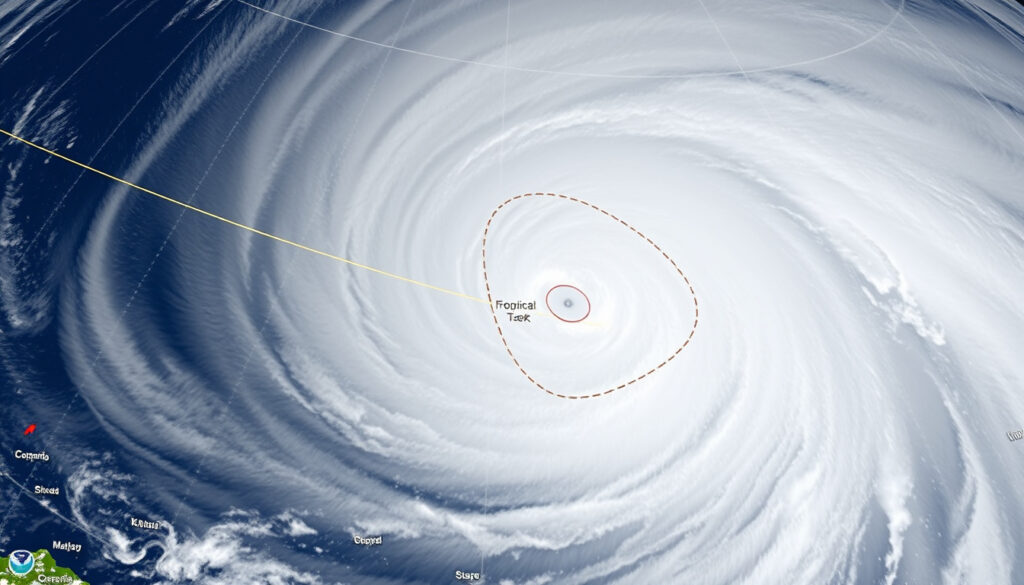
Tropical Cyclone Alfred Forecast 2025: Track, Safety, and Impact
When a cyclone’s predicted path can shift by hundreds of kilometres in 48 hours, the difference between a watch and a warning becomes a life-or-death calculation. Tropical Cyclone Alfred’s march toward southeast Queensland in early 2025 tested that margin, dropping from a Category 4 monster to a tropical storm before crossing the coast between Maroochydore and Brisbane, and here’s what the forecast actually showed, the safety lessons it left behind, and how this storm fits into Australia’s long cyclone history.
Max wind speed (Category 4): 215 km/h ·
Peak wind recorded near centre: 83 km/h (ship observation) ·
Active period: 22 February – 8 March 2025 ·
Landfall location (forecast): Between Maroochydore and Brisbane
Quick snapshot
- Category 4 (peak), downgraded to tropical storm (Bureau of Meteorology)
- Active 22 Feb – 8 Mar 2025 (Bureau of Meteorology)
- Expected landfall between Maroochydore and Brisbane (Bureau of Meteorology)
- Exact timing of landfall (predicted Saturday morning but subject to change)
- Total damage and casualty figures not yet reported
- Formed 22 Feb 2025, intensified to Category 4 by late February (Bureau of Meteorology)
- Downgraded to tropical storm 7 Mar 2025 (Bureau of Meteorology)
- Made landfall 8 Mar 2025 (Bureau of Meteorology)
- Residents should follow BoM track updates and local evacuation orders (Queensland Government Get Ready)
- Post-storm flood risk remains high in northern NSW rivers (Queensland Government Get Ready)
The following table summarises key facts about Severe Tropical Cyclone Alfred.
| Attribute | Value |
|---|---|
| Storm name | Severe Tropical Cyclone Alfred (22U) |
| Peak category | Category 4 |
| Maximum sustained wind (peak) | 165 km/h (90 knots) per Bureau of Meteorology |
| Lowest pressure | Not specified |
| Landfall area forecast | Southeast Queensland, near Brisbane |
| Official source | Bureau of Meteorology (Australia’s national weather authority) |
Where is Cyclone Alfred going to hit the most?
Forecast landfall area between Maroochydore and Brisbane
The Bureau of Meteorology’s path tracker showed the most likely crossing between Brisbane and the Sunshine Coast, specifically around Bribie Island and the mainland near Maroochydore. A BoM video update on 4 March 2025 confirmed the system was about 300 km east of Brisbane and tracking slowly west-southwest as a category 2 system (Bureau of Meteorology YouTube).
The storm had stalled overnight by 6 March 2025, delaying the expected crossing from “very late Thursday or very early Friday” to “late Friday night or early Saturday morning” (Bureau of Meteorology YouTube). This stall introduced significant uncertainty into the timing but kept the geographic target steady.
Impact zones in southeast Queensland and northern NSW
BoM warned of severe weather from Gympie down to the mid-north coast of New South Wales in the 6 March update (Bureau of Meteorology YouTube). Heavy to intense rainfall was forecast to intensify into Thursday and Friday, with six-hour totals exceeding 200 mm and 24-hour totals potentially reaching 400 mm, especially in the northern rivers of New South Wales and elevated terrain.
The risk of destructive gusts, reaching about 150 km/h in Brisbane and the Gold Coast, made prior preparation critical – the hazard window was a matter of hours, not days.
This forecast track uncertainty illustrates why evacuation decisions should be made as early as possible.
What is the eye of a cyclone?
Structure of a tropical cyclone
The eye of a cyclone is a region of calm, low pressure at the centre, surrounded by the eyewall — a ring of towering thunderstorms where the highest winds are recorded. The eye is typically 30 to 65 km in diameter for a well-developed tropical cyclone, according to the Bureau of Meteorology’s tropical cyclone knowledge centre.
- In the eye: light winds, clear skies, low pressure
- In the eyewall: the most extreme winds and heaviest rain
- Behind the eyewall: spiral rain bands stretching hundreds of kilometres
The BoM describes Alfred specifically as a system that transitioned into a sub-tropical cyclone before crossing Bribie Island, meaning its structure became less symmetrical and more elongated compared to a classic tropical cyclone (Bureau of Meteorology).
Why the eye is calm and clear
The calm at the centre is caused by centrifugal force pushing air outward, which prevents rising air from forming clouds. Descending air in the eye warms and dries, producing the characteristic clearing. BoM notes that while the eye itself is calm, it is a false signal of safety — the eyewall will soon follow with renewed violence (Bureau of Meteorology).
Understanding the eye’s structure helps residents recognise that the calm is temporary and the danger is not over.
Has Australia ever had a Category 5 cyclone?
Cyclone Mahina: the deadliest Category 5
Yes, Australia has recorded several Category 5 cyclones. Cyclone Mahina struck Bathurst Bay, Queensland in March 1899, producing the highest recorded storm surge in Australian history — over 13 metres in some areas. It remains the deadliest natural disaster in Australia’s maritime history, with approximately 400 lives lost, according to the Bureau of Meteorology’s cyclone climatology.
List of Category 5 cyclones that have hit Australia
The Bureau of Meteorology’s cyclone history records show at least 12 Category 5 cyclones in the Australian region since formal records began. Notable examples include:
- Cyclone Mahina (1899) — Category 5, 400+ deaths
- Cyclone Yasi (2011) — Category 5, crossed near Mission Beach, Queensland
- Cyclone Monica (2006) — Category 5, strongest Australian cyclone by recorded wind speed (285 km/h)
- Cyclone Marcia (2015) — Category 5, made landfall near Rockhampton
Alfred peaked at Category 4 with sustained winds of 165 km/h (90 knots) per the Bureau of Meteorology. It did not reach Category 5 status.
Alfred’s downgrade before landfall is not unusual — many Australian cyclones weaken near the coast as they encounter cooler water and increased wind shear. The risk profile for residents in the forecast zone depends less on the category label and more on the specific hazards: wind gusts, rainfall totals, and storm surge.
The comparison to past Category 5 cyclones highlights that even a Category 4 storm like Alfred requires serious respect.
Where is the safest place during a cyclone?
Safe areas inside a home
During a cyclone, the safest place inside your home is a small, windowless room on the lowest floor, such as a bathroom, hallway, or storage room. The Queensland Government’s Get Ready website advises residents to stay away from glass doors, skylights, and exterior walls. If you live in a high-rise building, move to a lower floor or designated shelter area.
Evacuation zones and shelters
If local authorities issue an evacuation order, leave immediately. The Queensland Disaster Management Services coordinate evacuation centres in each local government area. Key preparation steps include:
- Know your local storm tide zone
- Prepare an emergency kit with 3 days of food, water, and medications
- Identify the nearest evacuation centre before the warning period
In a sub-tropical cyclone like Alfred, inland flooding can be more dangerous than coastal wind damage. For southeast Queensland residents, the safest place might not be inside a home at all — if you are in a storm tide or flood-prone area, evacuation to a shelter is the only safe option.
Choosing between sheltering and evacuating is the most critical decision, and it must be based on local flood risk, not just wind speed.
Which country is the most prone to cyclones?
Global tropical cyclone basins
The Philippines tops global cyclone frequency lists, averaging about 20 tropical cyclones per year, according to the World Meteorological Organization’s tropical cyclone programme. The Western North Pacific basin — closest to the Philippines — is the most active basin on Earth, generating roughly one-third of all global tropical cyclones.
China and the United States follow closely in the frequency of landfalling cyclones (called typhoons in the Pacific, hurricanes in the Atlantic). The NOAA National Centers for Environmental Information reports that the U.S. experiences an average of 6 hurricane landfalls every 3 years across its Atlantic and Gulf coasts.
Most affected countries: Philippines, China, United States, Australia
Australia is the most cyclone-prone country in the Southern Hemisphere. Bureau of Meteorology records that the Australian region averages about 11 tropical cyclones per year, with around 4 crossing the coast. The most active areas are the northwest coast (Western Australia) and the Queensland coast. Indonesia, Bangladesh, and Madagascar also rank high for fatality risk due to a combination of cyclone frequency and population exposure in low-lying coastal areas.
For Australian readers, the key takeaway is that every coastal community in the tropics faces cyclone risk, even if the frequency varies. For those interested in the safety of these supplements, collagen peptides safety provides comprehensive details.
Which city is more likely to be hit by a cyclone?
Australian cities at risk
According to the Bureau of Meteorology’s cyclone climatology, the Australian cities with the highest historical cyclone frequency are Cairns and Townsville, both in north Queensland. These cities lie in the path of tropical cyclones that form in the Coral Sea and track westwards toward the coast. Cairns has experienced direct hits from Cyclone Tracy (though Tracy famously struck Darwin), Cyclone Yasi in 2011, and Cyclone Larry in 2006.
Relative risk: Brisbane vs. other coastal centres
Brisbane and other southeast Queensland cities face moderate risk compared to their northern neighbours. Bureau of Meteorology notes that cyclones making landfall south of Fraser Island are less common but can be very destructive when they occur — Alfred being the most recent example. The BoM recorded that Alfred was about 300 km east of Brisbane on 6 March 2025 (Bureau of Meteorology YouTube), placing the city well within the hazard zone.
The key difference is not whether a cyclone can hit Brisbane — it can — but how prepared the urban infrastructure is. Brisbane’s flood mitigation systems were heavily tested by the 2022 floods (not cyclone-related), so the city has recent experience with water management. However, wind protection for high-rise buildings and extensive tree coverage in the inner suburbs creates specific vulnerabilities that are different from the more exposed northern cities.
This relative risk assessment should inform long-term planning but does not diminish the immediate threat during an active cyclone watch.
Timeline: Tropical Cyclone Alfred
- 21 February 2025 — Tropical low 22U forms northeast of Cooktown (Bureau of Meteorology)
- 22 February 2025 — Tropical Cyclone Alfred is named
- 24 February 2025 — Alfred turns south overnight and continues to intensify, reaching Category 4
- Late February – early March 2025 — Alfred remains a severe tropical cyclone well offshore of Queensland
- 4 March 2025 — BoM reports Alfred is a category 2 system about 300 km east of Brisbane, likely to cross between Brisbane and Sunshine Coast late Thursday or early Friday
- 6 March 2025 — BoM says Alfred has stalled overnight, now expected to cross late Friday night or early Saturday morning; peak wind gust warning of 150 km/h
- 5 March 2025 — Ship observation records peak wind of 83 km/h about 330 km from centre
- 7 March 2025 — Alfred downgraded to tropical storm; evacuations in southeast Queensland
- 8 March 2025 — Ex-Tropical Cyclone Alfred makes landfall between Maroochydore and Brisbane, crossing Bribie Island then the mainland
The most important signal in Alfred’s timeline is the 48-hour stall on 5–6 March. For residents and emergency services, this delay meant the difference between a Friday day crossing (higher population movement, schools open) and a Saturday early morning crossing (lower exposure). The uncertainty in the final landfall window is the single biggest challenge in tropical cyclone forecasting.
Latest confirmed facts
- Alfred reached Category 4 intensity on 24 February 2025, with peak sustained winds of 165 km/h (Bureau of Meteorology)
- Downgraded to tropical storm before landfall (Bureau of Meteorology)
- Landfall occurred between Maroochydore and Brisbane on 8 March 2025 (Bureau of Meteorology)
What remains unclear
- Exact timing of landfall (predicted Saturday morning but subject to change)
- Total damage and casualty figures not yet reported
- Impact of Alfred’s transition to a sub-tropical cyclone on forecast accuracy (not yet assessed)
Expert perspectives on Alfred’s impact
“Alfred was a severe tropical cyclone that later became a sub-tropical cyclone before crossing Bribie Island and then the mainland. While it was a sub-tropical cyclone, its intensity ranged from 45 to 55 knots, or about 85 to 100 km/h, based on 10-minute mean winds.”
— Bureau of Meteorology, official cyclone history summary
“The most likely track suggested a crossing between Brisbane and the Sunshine Coast. The strongest destructive wind gusts could reach about 150 km/h in places such as Brisbane, the Gold Coast and surrounding elevated areas.”
— BoM spokesperson, 4 March 2025 forecast update
The Bureau of Meteorology warned on 6 March that heavy to intense rainfall would intensify into Thursday and Friday, with six-hour totals exceeding 200 mm and 24-hour totals potentially reaching 400 mm, especially in the northern rivers of New South Wales and elevated terrain (Bureau of Meteorology YouTube).
Severe weather was expected from Gympie down to the mid-north coast of New South Wales, according to the same 6 March update (Bureau of Meteorology YouTube).
The thread running through every update is the same: the track was broadly predictable, but the intensity and timing were not. Alfred’s stall before landfall added hours of uncertainty to evacuation decisions across southeast Queensland.
Understanding the forecast is crucial, but equally important are the flooding impacts of Tropical Cyclone Alfred that may follow even after the storm passes.
Frequently asked questions
What is the current strength of Cyclone Alfred?
Alfred peaked at Category 4 with 165 km/h winds, then weakened to a tropical storm before crossing the coast on 8 March 2025 (Bureau of Meteorology). It is no longer active.
Where is Cyclone Alfred expected to make landfall?
BoM forecast landfall between Maroochydore and Brisbane, with the system crossing Bribie Island then the mainland (Bureau of Meteorology YouTube).
When did Cyclone Alfred begin and when did it end?
Alfred formed as Tropical Low 22U on 21 February 2025, was named on 22 February, and made landfall as an ex-tropical cyclone on 8 March 2025 (Bureau of Meteorology).
Has Australia experienced cyclones of similar intensity before?
Yes. Australia has recorded at least 12 Category 5 cyclones, including Cyclone Mahina (1899) and Cyclone Yasi (2011). Alfred reached Category 4 (Bureau of Meteorology cyclone history).
What should residents in the forecast area do to prepare?
Follow BoM track updates via their cyclone warnings page, identify your nearest evacuation centre, prepare a 3-day emergency kit, and follow local emergency services guidance.
What is the safest place during a cyclone?
A small, windowless room on the lowest floor of a sturdy building, according to the Queensland Government Get Ready website. If in a flood-prone area, evacuate.
Which Australian city is more likely to be hit by a cyclone?
Cairns and Townsville have the highest historical cyclone frequency in Australia. Brisbane faces moderate risk (Bureau of Meteorology cyclone climatology).
For residents of southeast Queensland, the choice to evacuate or shelter in place is the single most consequential decision during any cyclone watch. Alfred’s forecast-to-impact path showed that even a weakening storm carries destructive wind gusts, life-threatening rainfall totals, and dangerous coastal wave hazards. The safest decision is the one made early — before the track uncertainty resolves, not after.
More related posts
 How Many Countries in Africa? 54 African Countries (2025)
 Animals Starting With X: Complete List and Fun Facts
 New Zealand New Year’s Eve Weather – 2025 City Forecasts and Risks
 Chelsea vs Crystal Palace: Unbeaten Streak & Match Preview
 Adobe QR Code Generator: Free Forever? (2025 Review)
 Westpac NZ Home Loan Buffer: Rates & Refinance Guide
 How to Use Command Prompt: Step-by-Step Guide for Beginners
 Situs Gaming idrhoki138: What Is It and Is It Legit
