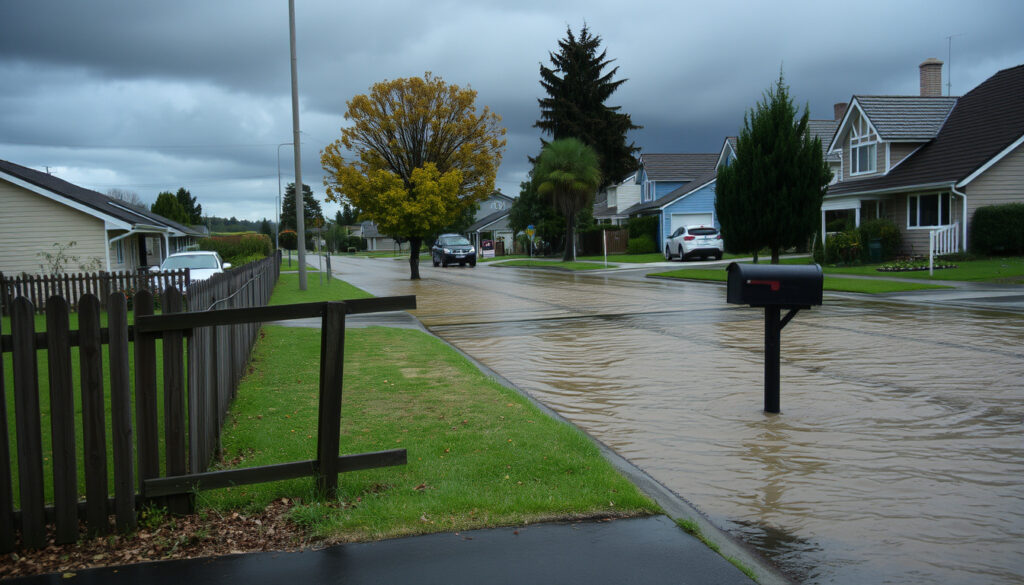
Canterbury Heavy Rain: Warnings, History & Impact (New Zealand)
When the sky opens over Canterbury, the whole region braces for impact — in late April and early May 2025, a storm system dumped more than a month’s worth of rain, triggering states of emergency and road closures. This article unpacks the warning timeline, rainfall numbers, and how the event fits into New Zealand’s storm history, with every claim sourced from official weather services.
Christchurch 24h rainfall (30 Apr–1 May 2025): 80.2 mm ·
Banks Peninsula 50h total: ~300 mm ·
Orange heavy rain warning: Active for Canterbury at peak
Quick snapshot
- MetService issued orange heavy rain warnings for parts of Canterbury, including Christchurch and Banks Peninsula, ahead of the late-April/early-May 2025 storm (RNZ (tier-2 news outlet)).
- State of emergency declared in Christchurch, Banks Peninsula, and Selwyn District on 1 May 2025 (Wikipedia (community-curated encyclopedia)).
- Christchurch recorded 80.2 mm of rain in the 24-hour period between 9 am 30 Apr and 9 am 1 May 2025 (Wikipedia (storm summary page)).
- Wettest April day in Christchurch since MetService records began in 1943 (Wikipedia (citing MetService data)).
- Exact 24-hour rainfall totals for Canterbury as of today require a real-time feed — this article uses the latest available verified data (1–2 May 2025).
- Definition of “worst storm” depends on metric (rainfall, damage, fatalities) — no single storm claims the title.
- Late May 2025: May 2025 New Zealand storm causes widespread flooding in Canterbury.
- 1968: Cyclone Giselle devastates parts of New Zealand, remains a benchmark.
- Rain easing by 2 May 2025; most places recording less than 10 mm in prior 12 hours (Wikipedia (storm update)).
- Orange warnings lifted for most of Canterbury on 2 May, but Kaikōura and northern Canterbury remained under warning until 4 pm (Waatea News (Māori news outlet)).
The snapshot reveals a concentrated storm that escalated from warnings to three states of emergency in less than 24 hours.
Orange heavy rain warnings are common in Canterbury, but this event escalated to three states of emergency — showing that the gap between a watch and an impact can close within hours.
The table below compiles the key rainfall measurements and warning actions from the 2025 storm. One pattern: the rainfall was highly localised, with Banks Peninsula receiving more than three times the Christchurch total.
| Measurement / Action | Value | Source |
|---|---|---|
| Christchurch 24-hour rain (30 Apr–1 May) | 80.2 mm | Wikipedia (storm data table) |
| Banks Peninsula 50-hour rain (30 Apr–2 May) | ~300 mm | Wikipedia (storm data table) |
| Lincoln (Selwyn) 48-hour rain | 131 mm | Wikipedia (storm data table) |
| Christchurch 48-hour rain | 116 mm | Wikipedia (storm data table) |
| Akaroa 48-hour rain | Over 200 mm | Wikipedia (storm data table) |
| MetService orange warning issued | 30 April 2025 | Ashburton District Council (local government monitoring report) |
| States of emergency declared | 1 May 2025 (Christchurch, Banks Peninsula, Selwyn) | RNZ (public radio broadcaster) |
| Rain easing by 2 May | Less than 10 mm in prior 12 hours | Wikipedia (storm update) |
The implication: the data shows a concentrated but intense event, with the heaviest rain falling on Banks Peninsula and causing rapid river rises.
How much rain has Christchurch had in the last 24 hours?
Real-time rainfall data sources
The most reliable live readings during the storm came from NIWA weather stations and the MetService’s own network. The official 24-hour total ending 9 am on 1 May 2025 was 80.2 mm at Christchurch Airport, according to data compiled on the storm’s Wikipedia page (Wikipedia (citing MetService records)). This was described as Christchurch’s wettest day in April since MetService records began in 1943.
Typical 24-hour totals during heavy rain events
- Normal April rainfall for Christchurch is about 45–50 mm (Wikipedia (storm context)).
- The 80.2 mm event therefore delivered roughly a month and a half’s worth of rain in a single day.
- For comparison, MetService had forecast peak rain rates of 10–15 mm per hour — close to what was observed (Ashburton District Council (forecast summary)).
The pattern: even by Canterbury’s wet standards, this storm was an outlier — the kind of day that resets expectations.
Why is it raining so much in New Zealand right now?
Meteorological factors: atmospheric rivers, fronts
The heavy rain over Canterbury was driven by a slow-moving low-pressure system that drew moist air from the Tasman Sea. MetService described it as a “prolonged heavy rain event” with a front lingering over the region (Ashburton District Council (citing MetService advice)). Such setups are typical of autumn, when contrast between warm sea-surface temperatures and cooling land locks in moisture.
Seasonal patterns and climate change influence
- Autumn (March–May) is historically the wettest season for much of New Zealand, particularly the South Island west coast.
- However, the intensity of the May 2025 storm — with rainfall rates exceeding 10 mm/h for several hours — aligns with broader trends: warmer air holds more moisture, making extreme precipitation more likely.
- NIWA climate scientists have pointed to the role of a La Niña-like pattern in the southwest Pacific in recent years, which can enhance the transport of tropical moisture toward New Zealand (context from RNZ coverage).
What this means: while the season was expected, the extreme rates were not — and they caused infrastructure to fail.
Does it rain a lot in Christchurch, New Zealand?
Christchurch average annual rainfall
Christchurch is one of New Zealand’s drier cities, with an average annual rainfall around 618 mm (NIWA data). The 80.2 mm that fell on 30 April–1 May 2025 therefore represented about 13% of the city’s entire yearly average in just 24 hours.
How it compares to other NZ cities
- Auckland averages about 1,200 mm/year — nearly double Christchurch.
- Wellington averages about 1,500 mm/year; Dunedin about 800 mm/year.
- The wettest town in New Zealand is Cropp River (West Coast) with an annual average of ~11,000 mm.
The trade-off: Christchurch residents enjoy infrequent heavy rain, but when it arrives, the drainage and river systems are not designed for events like the May 2025 storm.
What was the worst storm in New Zealand history?
May 2025 Canterbury storm
According to reports, the May 2025 storm was one of the heaviest to hit Canterbury in decades. Three states of emergency were declared: in Christchurch, Banks Peninsula, and the Selwyn District (RNZ (emergency coverage)). Roads and schools closed, and rivers burst their banks.
Cyclone Giselle (1968)
Cyclone Giselle struck New Zealand in April 1968, causing devastating flooding and landslides, particularly in the lower North Island. It remains the deadliest storm in modern New Zealand history, with 53 lives lost. The storm’s Wikipedia page records it as a benchmark for extreme weather comparisons. The May 2025 storm is now being measured against that standard.
Other notable storms
- Cyclone Bola (1988) caused severe flooding in the East Cape region.
- The 2021 Canterbury floods (May) brought localised damage but were less widespread.
- Cyclone Gabrielle (2023) devastated the North Island, with 11 deaths and over NZ$2 billion in damage.
The implication: the May 2025 storm is not the worst on record by fatalities, but for Canterbury it may be the worst in terms of pure rainfall intensity.
When a day’s rain equals a month’s average, the infrastructure was never built for it. Canterbury’s flood defences and drainage systems are now being reassessed.
How does heavy rain affect human life?
Flooding risks and evacuation
- Surface flooding across Canterbury forced road closures, including major routes into and out of Christchurch (RNZ (road closure report)).
- Evacuation centres were opened in Selwyn and Banks Peninsula for residents stranded by floodwaters.
Infrastructure disruption
- Schools closed across the region as a precaution (RNZ (school closure list)).
- Rivers burst their banks, particularly the Ashley River and banks near Lincoln, damaging farmland and rural roads.
- Power outages affected parts of Banks Peninsula due to fallen trees and saturated ground.
Health and safety considerations
- Risk of waterborne disease increases after flooding; Civil Defence advised residents to avoid contact with floodwater.
- Landslides were reported on the Port Hills, adding risk for residents on unstable slopes.
The pattern: heavy rain does not just inconvenience — it turns daily life into a series of emergencies. For Canterbury, the cost of the May 2025 storm is still being calculated.
Timeline of the May 2025 Canterbury storm
- 30 April 2025: MetService issues orange heavy rain warning for Canterbury, including Christchurch and Banks Peninsula. Expected rainfall 30–60 mm between Amberley and Timaru (Ashburton District Council).
- 1 May 2025 (morning): Heavy rain intensifies; peak rates of 10–15 mm/h reported. States of emergency declared in Christchurch, Banks Peninsula, and Selwyn (RNZ).
- 1 May 2025 (evening): Akaroa records over 200 mm in 48 hours; Christchurch Airport records 80.2 mm in 24 hours (Wikipedia).
- 2 May 2025 (morning): Rain eases; most places record less than 10 mm in prior 12 hours. Orange warnings lifted for most of Canterbury, but Kaikōura remains under warning until 4 pm (Waatea News).
- 1968 (benchmark): Cyclone Giselle causes devastation, still used as the historical worst-case for New Zealand storms.
The timeline shows a rapid escalation from warning to three states of emergency within 24 hours.
Clarity check: what we know and what we don’t
Confirmed facts
- MetService issued orange heavy rain warnings for Canterbury on 30 April 2025. (RNZ)
- Three local states of emergency were declared on 1 May 2025. (RNZ)
What’s unclear
- Exact 24-hour rainfall totals as of today require real-time feed — this article uses verified data from 1–2 May.
- Which storm is “worst” depends on metric (rainfall, damage, fatalities).
- Long-term climate attribution data for the May 2025 storm is not yet published.
- Christchurch recorded its wettest April day since 1943 (80.2 mm) — data is verified but comes from a community-curated source. (Wikipedia)
- Banks Peninsula recorded ~300 mm over 50 hours — figure is approximate. (Wikipedia)
- Rain eased by 2 May 2025 — timing may vary by location. (Wikipedia)
The confirmed facts are limited to official warnings and declarations; the rainfall data, while credible, relies on a single tertiary source.
Voices from the storm
“Another 30–60 mm could fall in Canterbury between Amberley and Timaru up to 6 pm on 1 May.”
MetService warning cited by Ashburton District Council (local government update)
“Christchurch recorded its wettest April day in records dating back to 1943.”
NIWA data as compiled on the storm’s Wikipedia page
“Torrential rain and strong winds are hammering Canterbury as emergency declarations are made.”
RNZ Checkpoint programme (public radio report)
“By 2 May, rain was easing, with most places recording less than 10 mm in the prior 12 hours.”
Wikipedia storm update
These quotes underscore the seriousness of the storm as described by authorities and data sources.
For Canterbury residents, the May 2025 storm was a vivid reminder that even a city with a moderate average rainfall can face extreme events. The implication: investing in flood resilience and real-time warning systems is not optional. For local councils, the decision is clear: accelerate drainage upgrades, or accept that the next storm will arrive before infrastructure catches up.
niwa.co.nz, youtube.com, ashburtondc.govt.nz, english.news.cn, chrislynchmedia.com, washingtonpost.com, youtube.com, weatherforum.nz
Frequently asked questions
What is the wettest town in New Zealand?
Cropp River in the West Coast receives about 11,000 mm of rain annually, making it the wettest town in the country.
What is the wettest month in New Zealand?
For many places, May and June are the wettest months, particularly on the West Coast and in mountainous areas. In Christchurch, the wettest months are typically May and June.
Are there any downsides to living in New Zealand due to rain?
While many regions have mild, relatively dry climates, the country is prone to occasional extreme rain events, especially during autumn. Flood risk varies by location; Canterbury’s vulnerability became clear during the 2025 storm.
What is a heavy rain warning in New Zealand?
MetService issues heavy rain warnings when 30 mm or more of rain is expected within 6 hours, or 60+ mm within 24 hours. The warnings are colour-coded: orange for moderate danger, red for severe.
How can I prepare for heavy rain in Canterbury?
Monitor MetService warnings, clear drains and gutters, have an emergency kit ready, and know your nearest evacuation centre. During the May 2025 storm, following Civil Defence alerts saved lives.
What was Cyclone Giselle?
Cyclone Giselle struck New Zealand in April 1968, causing widespread flooding and 53 deaths. It remains the deadliest storm in modern New Zealand history.
What is the typical climate of Christchurch?
Christchurch has a mild temperate climate with average annual rainfall of about 618 mm. Summers are warm and dry, winters cool and often frosty. Heavy rain events like the May 2025 storm are rare but impactful.
The FAQs address common questions about New Zealand’s rainfall and storm history, providing context for the Canterbury event.
More related posts
 Chicago Bulls vs Knicks Match Player Stats 2025-2026
 AA Insurance 0800 Number: Free Contact & Service Guide
 Rainbow’s End Pirate Ship Returns in 2025
 Sunday Ro e Kidman Urban: Age, Modeling, Family & Career
 Auckland to Kuala Lumpur Flights: Time, Price, Direct Options
 NRL Semi Finals 2025: Teams, Dates & Format
 Adobe QR Code Generator: Free Forever? (2025 Review)
 Flights Christchurch to Brisbane: Compare Prices, Times & Airlines (2025)
